Better Technologies · Better Nature · Better Life更好的技术 · 更好的自然 · 更好的生活
Nature AI Lab is an international, interdisciplinary research institution that combines cutting-edge artificial intelligence with environmental research to address the pressing challenges of our urban and natural landscapes. Founded by scholars with international academic backgrounds and driven by real, verifiable research output, our team works across four research directions — Human–Nature Intelligence, Urban Vitality & Equity, Environmental Sensing & Spatial AI, and Computational Urbanism & Future Landscapes — toward sustainable, equitable, and resilient futures.Nature AI Lab 是一个国际化、跨学科的研究机构,融合前沿人工智能与环境研究,应对城市与自然景观所面临的紧迫挑战。实验室由具有国际学术背景的学者创立,以真实、可验证的研究成果为驱动,围绕四个研究方向——人与自然智能(HNI)、城市活力与公平(UVE)、环境感知与空间智能(ESP)、计算城市主义与未来景观(CUF)——推动可持续、公平且具有韧性的未来。
0+
SCI / SSCI PublicationsSCI / SSCI 论文
0+
Google Scholar CitationsGoogle 学术引用
0+
Global Study Sites全球研究地点
0+
Global University Partners全球高校合作伙伴
Projects
-1024x500.webp)
No projects found.没有找到匹配的项目。
Platforms & Tools
平台与工具


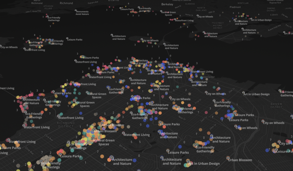
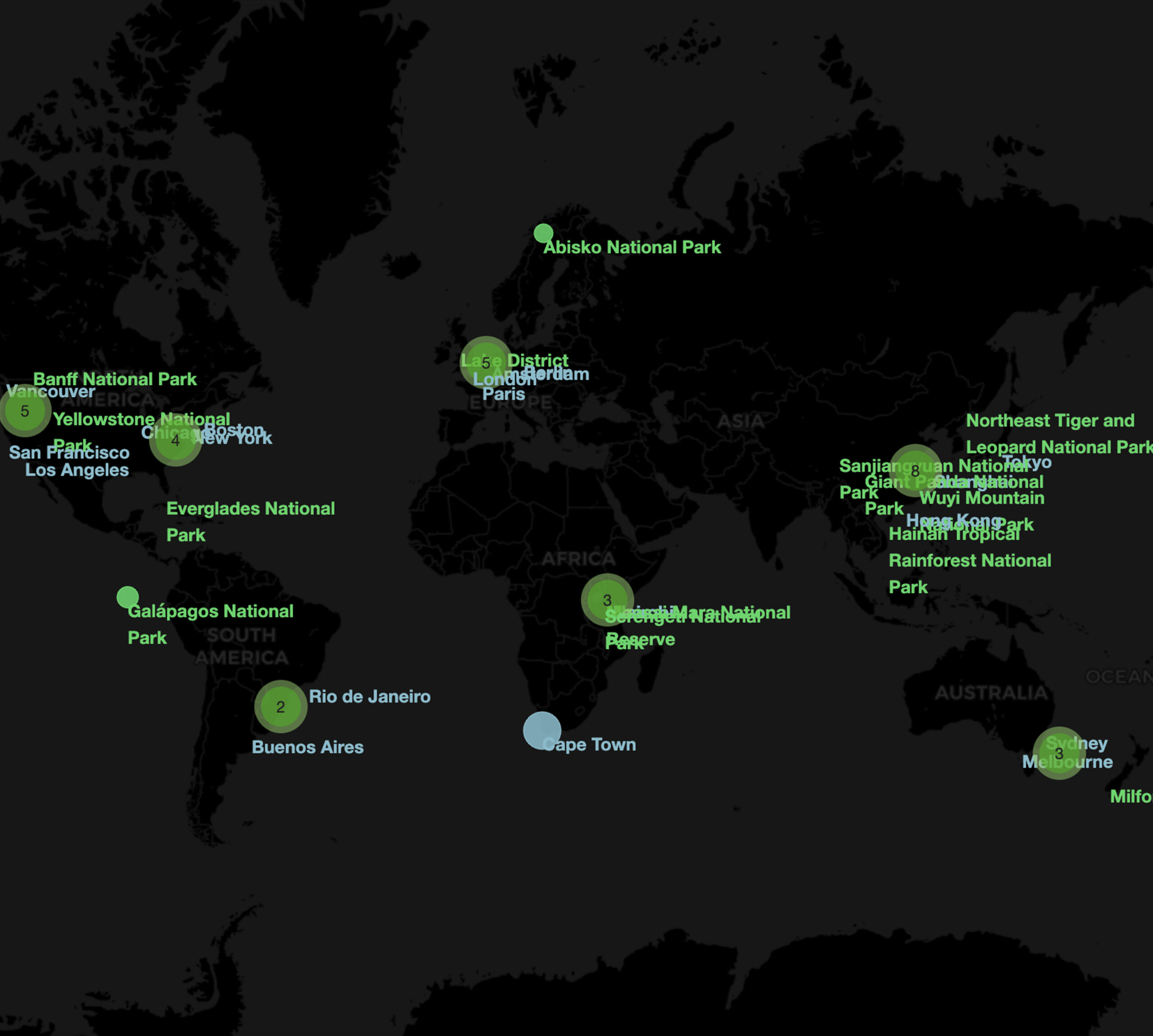
Around the World全球足迹
Where Our Research Happens我们的研究城市
The cities and parks our published studies are grounded in — filter by region, explore the map, or browse the index.我们已发表研究的真实研究场地——按区域筛选、在地图上探索,或浏览右侧索引。
18
study sites研究地点
3 continents · 14 cities · 4 national parks3 大洲 · 14 城市 · 4 国家公园
City studies城市研究
National parks国家公园
Four Directions四大方向
Nature AI Research ThemesNature AI 研究主题
Our mission is to create innovative, human-centered solutions that promote sustainable development, enhance well-being, and foster equitable and resilient futures.我们的使命是创造以人为本的创新解决方案,推动可持续发展、提升福祉,并促进公平且具有韧性的未来。
HNI
Human–Nature Intelligence人与自然智能
Studying how people perceive, experience, and interact with natural environments — combining computer vision, sensing, and behavioral analytics.研究人们如何感知、体验自然环境并与之互动——结合计算机视觉、传感与行为分析。
UVE
Urban Vitality, Equity & Resilience城市活力、公平与韧性
Examining spatial inequality, environmental justice, and urban vitality through multi-city comparison and policy-oriented analysis.通过多城市比较与面向政策的分析,考察空间不平等、环境正义与城市活力。
ESP
Environmental Sensing & Spatial AI环境感知与空间智能
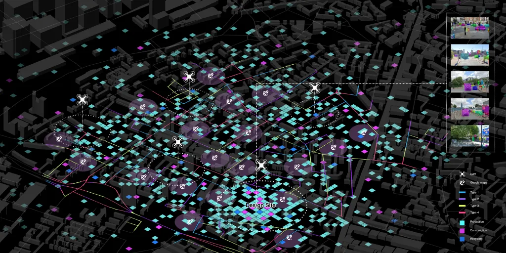
Building AI sensing systems, geospatial models, and digital twins toward a crowdsourced framework for environmental intelligence.构建 AI 传感系统、地理空间模型与数字孪生,迈向众包式的环境智能框架。
CUF
Computational Urbanism & Future Landscapes计算城市主义与未来景观
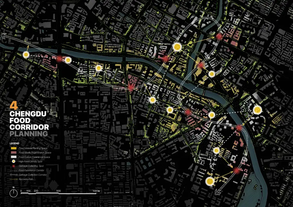
Integrating AI with computational design and spatial intelligence for sustainable urban planning and landscape systems.将 AI 与计算设计、空间智能相结合,服务于可持续的城市规划与景观系统。
What We Offer我们提供
Nature AI ServicesNature AI 技术服务
From research to deployment, we deliver high-impact technical services for universities, research centers, and industry partners — turning cutting-edge AI and spatial analytics into verifiable, decision-ready insights. We collaborate with academic institutions, industry partners, and community organizations to drive meaningful, measurable change.从研究到落地,我们为高校、研究机构与产业伙伴提供高影响力的技术服务——把前沿 AI 与空间分析转化为可验证、可决策的洞见。我们与学术机构、产业伙伴及社区组织合作,推动有意义、可衡量的改变。
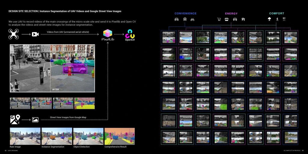
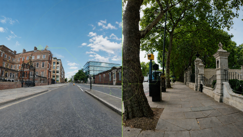
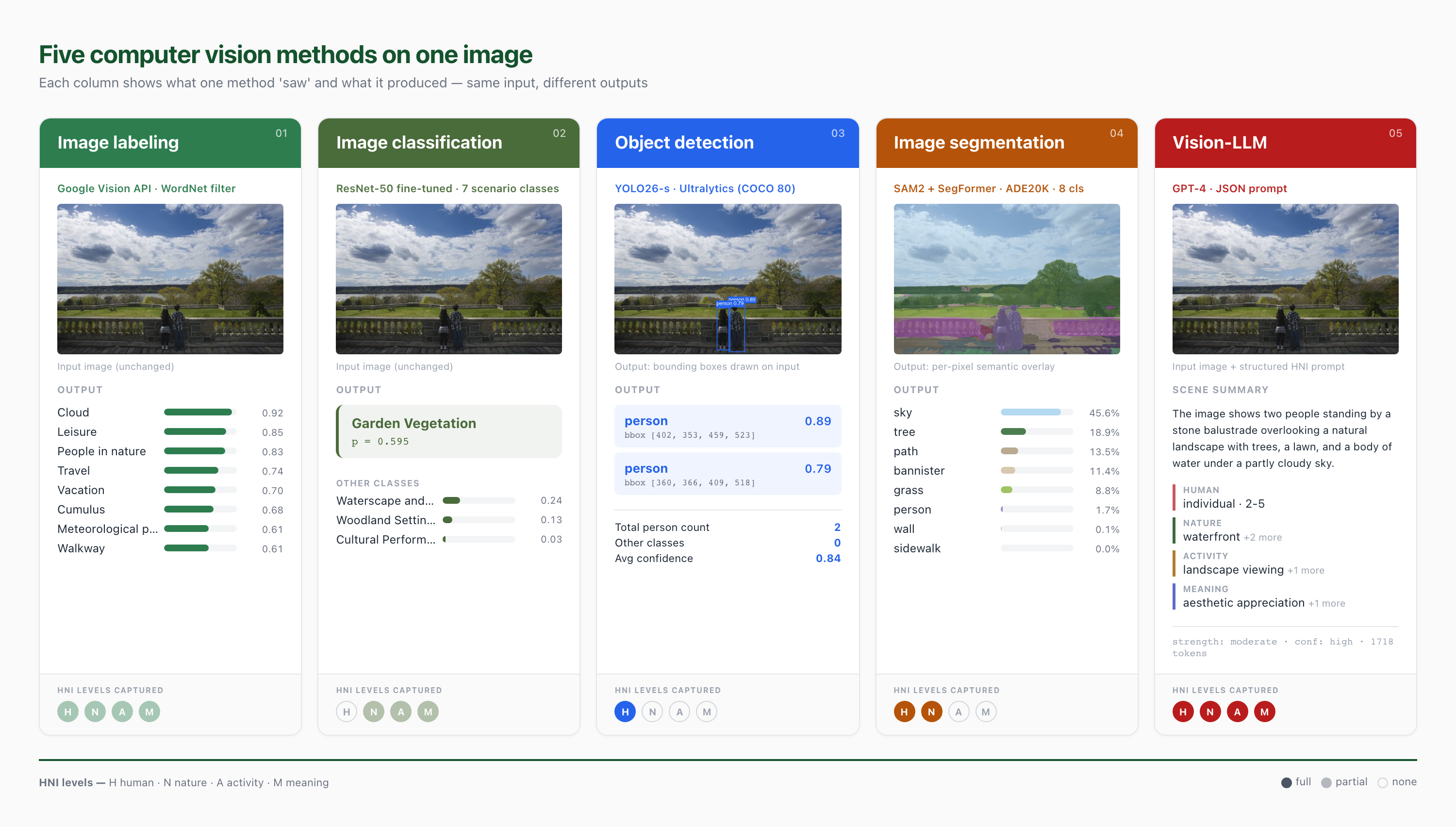
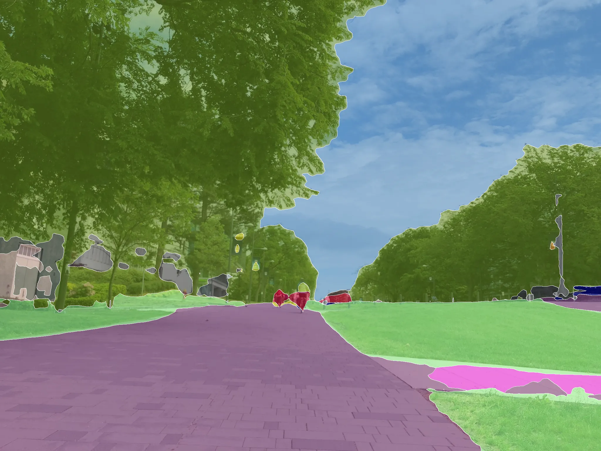
Utilizing advanced deep learning techniques to analyze diverse data sources, including street view imagery, Flickr, and Google Reviews, to gain nuanced insights into urban environments.
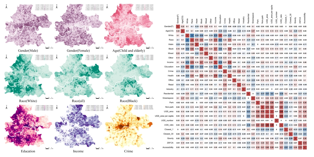
Social-economic Data Scraping and Mapping refers to the collection of demographic, economic, and social indicators from diverse digital sources, such as government open data portals, census databases, online platforms, and statistical reports. Their integration into geospatial frameworks for analysis.
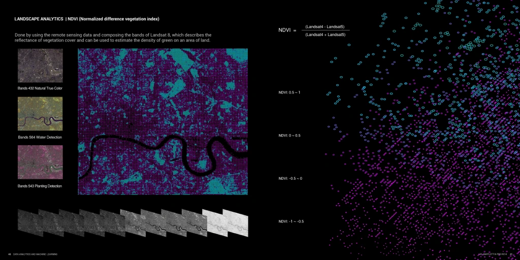
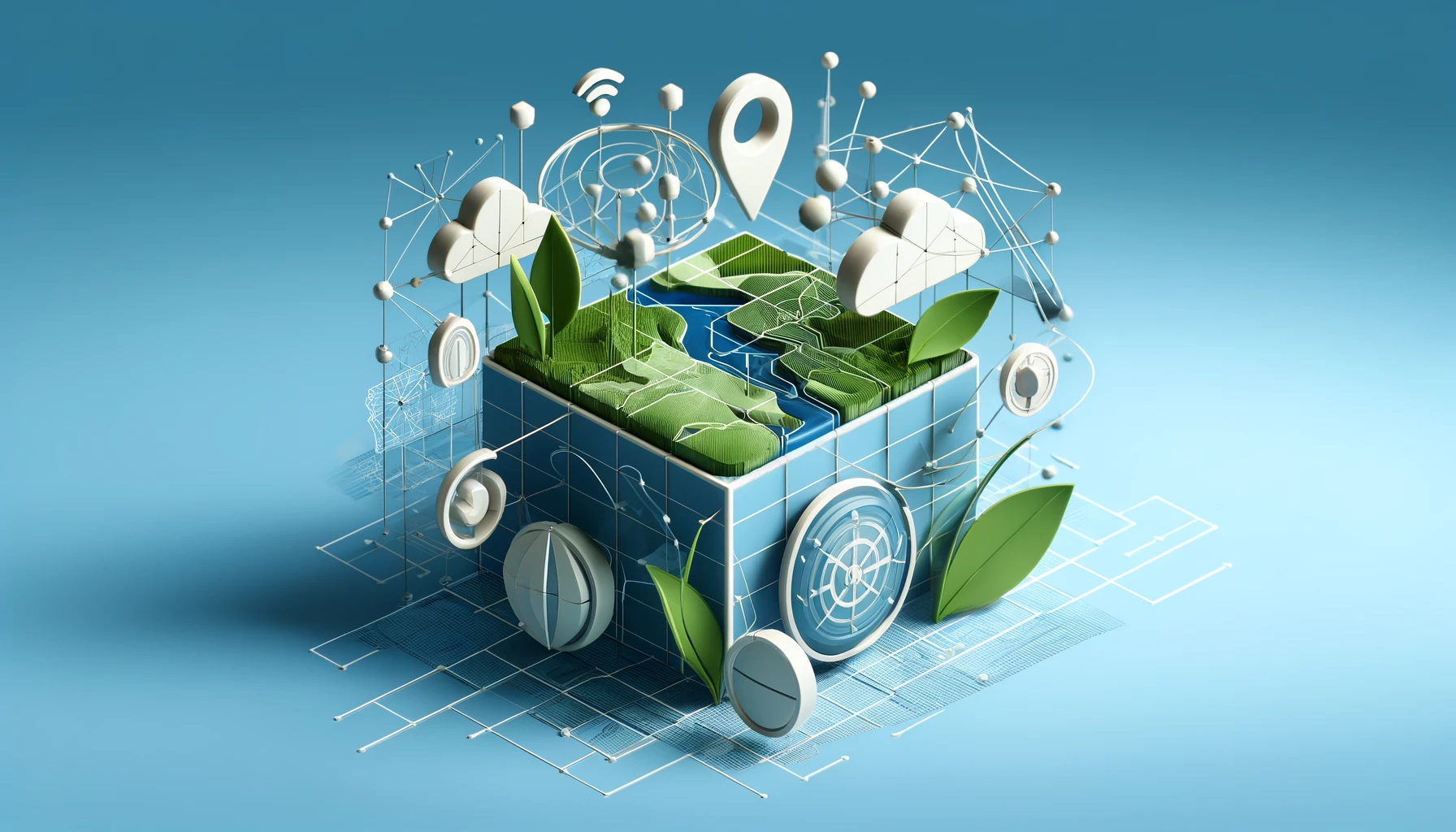
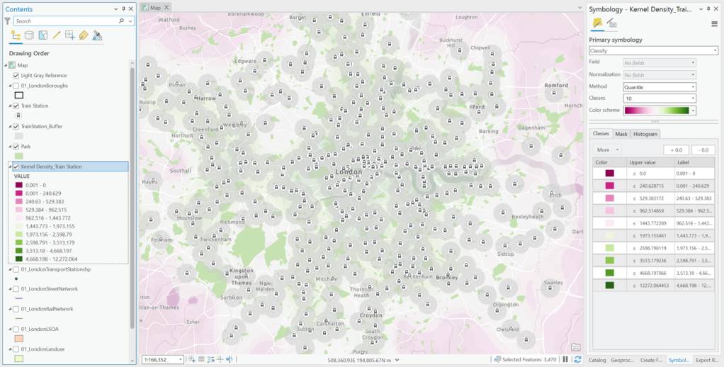
Remote Sensing and GIS refers to the combined use of satellite imagery, aerial photography, and geospatial information systems to capture, analyze, and manage spatial data at multiple scales. Remote sensing provides continuous, large-area observations of land cover, vegetation health, water resources, and urban morphology, while GIS integrates these datasets with demographic, infrastructural, and environmental information.
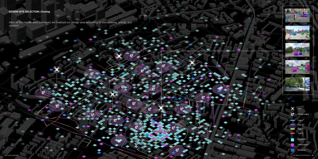
Smart Sensor Deployment and Visualization refers to the integration of sensor networks into urban spaces to capture fine-grained, real-time data on environmental and social dynamics. These sensors may include air quality monitors, noise detectors, traffic counters, energy meters, and motion sensors strategically placed across streets, parks, and infrastructure nodes.
The Transportation and Mobility dataset is a structured collection of spatial and behavioral data that records how people and goods move through urban and regional environments. It includes information on road networks, public transit systems, travel demand, commuting patterns, traffic flow, and accessibility across multiple transport modes.
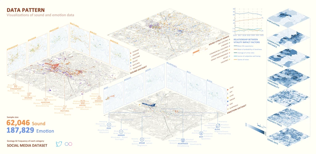
Spatial Data Visualization and Statistics refers to the process of transforming geographic data into intuitive maps, charts, and quantitative indicators to reveal spatial patterns and relationships. By combining visualization techniques with spatial statistical methods such as clustering, autocorrelation, and regression models, it enables researchers and planners to identify hotspots, analyze inequalities, and simulate future trend.